 How to resolve AdBlock issue?
News
- Details
- Written by: Elizabeth Larson
Lake County and a swath of other Northern California counties could see thunderstorms on Tuesday, according to the National Weather Service.
Forecasters also anticipate rain for Lake County through Thursday.
For the 24-hour period ending at 2 a.m. Tuesday, the following rainfall totals — in inches — were reported at National Weather Service observation stations:
• Cobb: 0.48;
• Hidden Valley Lake: 0.59;
• Kelseyville: 0.54;
• Lake Pillsbury: 0.64;
• Lower Lake: 0.29;
• Upper Lake: 0.61.
The National Weather Service’s forecast said a weather pattern moving over the North Coast will potentially bring a chance of thunderstorm activity on Tuesday to Lake and Mendocino
Counties.
Light winds are forecast throughout much of the week, rising to gusts as high as 20 miles per hour on Thursday night.
From Thursday through the weekend, conditions are forecast to move between partly cloudy and mostly sunny.
Daytime temperatures through Monday are expected to range between 54 degrees on Tuesday to 67 degrees on Monday. Nighttime conditions will hover in the low 40s.
Email Elizabeth Larson at
- Details
- Written by: LAKE COUNTY NEWS REPORTS
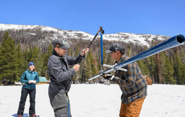
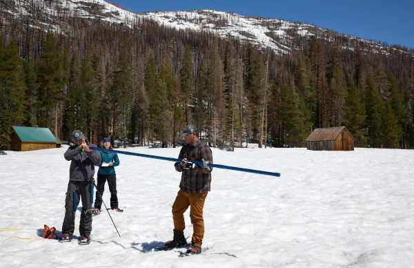
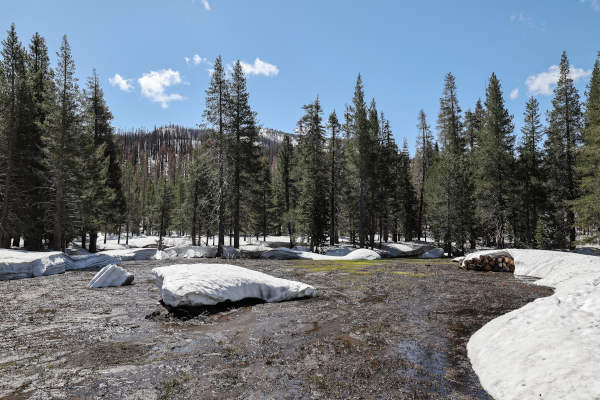
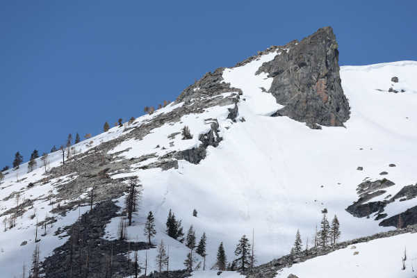
The latest state snow survey, conducted on Monday, shows California’s snowpack remains dee and strong, one of the largest since recordings began.
The Department of Water Resources, or DWR, on Monday conducted the fifth snow survey of the season at Phillips Station.
The manual survey recorded 59 inches of snow depth and a snow water equivalent of 30 inches, which is 241% of average for this location on May 1.
The snow water equivalent measures the amount of water still contained in the snowpack and is a key component of DWR’s water supply run-off forecast.
DWR’s electronic readings from 130 snow sensors placed throughout the state indicate the statewide snowpack’s snow water equivalent is 49.2 inches, or 254% of average for this date.
Despite a brief increase in temperatures in late April, the statewide snowpack overall melted at a slower pace than average over the month of April due to below average temperatures early in the month and increased cloud cover.
An average of 12 inches of the snowpack’s snow water equivalent has melted in the past month and it now contains an average of 49.2 inches.
Snow surveys like the one at Phillips Station are critical to planning for impacts of the coming snowmelt runoff on communities.
DWR uses the most updated technology to gather data from snow surveys, a network of 130 remote snow sensors, and airborne snow observatory data to gather information on current real-world conditions to create the most accurate snowmelt runoff forecasts possible.
These runoff forecasts, published through DWR’s Bulletin 120, allow reservoir operators to plan for anticipated inflows and water managers downstream of reservoirs to plan and prepare for flood risks.
“While providing a significant boost to California’s water supplies, this year’s massive snowpack is posing continued flood risks in the San Joaquin Valley,” said DWR Director Karla Nemeth. “The snowpack will not disappear in one week or one month but will lead to sustained high flows across the San Joaquin and Tulare Basins over the next several months and this data will help us inform water managers and ultimately help protect communities in these regions.”
The last time there was measurable snow at the Phillips snow course on May 1 was 2020, when only 1.5 inches of snow and .5 inches of snow water equivalent was measured.
“No matter how you look at the data, only a handful of years in the historical record compare to this year’s results,” said Sean de Guzman, manager of DWR’s Snow Surveys and Water Supply Forecasting Unit. “Survey results from our partners in the California Cooperative Snow Surveys Program and other data, including data from Airborne Snow Observatory flights, allow us to incorporate these data into our models to provide the most accurate snowmelt runoff forecasts possible right now to inform water supply, flood control, and planning.”
According to historical records, only the April 1 measurements from the years 1952, 1969, 1983 and this year were above 200%, although it is difficult to directly compare individual years across the decades due to changes in the number of snow courses measured over time.
Due to the impact of climate change on California’s snowpack, since 2021, snowpack averages have been calculated using a timeframe of 1991 through 2020 so that results better reflect the current climate conditions.
DWR is maximizing the amount of water that can be stored and diverted from this record snowpack.
In April, DWR announced a 100% allocation of requested supplies from the State Water Project, or SWP, which delivers water to 29 public water agencies that serve 27 million Californians and 750,000 acres of farmland.
The last time the SWP allocated 100% was in 2006. DWR is also maximizing the amount of water that can be diverted towards recharging groundwater basins so more water is stored for future use in underground reservoirs.
Last week, Gov. Gavin Newsom visited the Tulare Basin to tour flood impacts firsthand, met with community leaders and emphasized the state’s commitment to supporting and providing appropriate assistance to counties impacted by recent and anticipated flooding this spring and summer.
Snowmelt runoff forecasts are an instrumental part of the assistance provided by DWR’s State-Federal Flood Operations Center, or FOC, which is supporting emergency response in the Tulare Lake Basin and Lower San Joaquin River by providing technical and materials assistance to support ongoing flood response activities.
Storms this year have caused impacts across the state including flooding in the community of Pajaro and communities in Sacramento, Tulare and Merced counties. The FOC has helped Californians by providing more than 1.4 million sandbags, 1 million square feet of plastic sheeting, and 9,000 feet of reinforcing muscle wall, across the state since January.
- Details
- Written by: LAKE COUNTY NEWS REPORTS
California has two tribes that have declared a state of emergency because of violence against their tribal members.
Round Valley Indian Tribes declared a state of emergency in April, after two members were found murdered, the latest victims in Northern California of Missing or Murdered Indigenous People.
The tribal action was preceded in December of 2021 by the Yurok Tribe, in Humboldt County.
The Yurok Tribe action followed seven women reported being approached by possible traffickers and the still-unsolved case of Emmilee Risling, reported missing in October 2021.
The Yurok Tribe has been at the forefront in confronting the crisis and called for a summit of California tribes and others held last year to address the issue.
Summit participants called for implementation of a public notification alert when Native Americans go missing — the 2022 “Feather Alert” law, similar to the Amber Alert, written by Assemblymember James C. Ramos (D-San Bernardino).
In Lake County, Tribal Health is planning a special community event to draw attention to the MMIP epidemic on Friday, May 5, from 2 to 7 p.m. at 1950 Parallel Drive in Lakeport.
MMIP WEEK OF CAPITOL ACTIVITIES
• Tuesday, May 2, 8:30 to 9:15 a.m.: News briefing in State Capitol Room 317 on the vital issues spotlighted this week. Attending will be tribal chairpersons, including two who have issued emergency declarations on this issue, as well as Ramos, other lawmakers, advocates, and members of the Assembly Select Committee on Native American Affairs. It will be livestreamed on Ramos’ Facebook page and YouTube.
• Tuesday, May 2, through Friday, May 5: Capitol Dome illuminated in red for the first time ever to commemorate Missing or Murdered Indigenous People.
• Tuesday, May 2, 9:30 a.m. to noon: Assembly Select Committee on Native American Affairs informational hearing on MMIP entitled, “Not Invisible: California’s Work to Combat the Crisis of Missing and Murdered Indigenous People.” State Capitol, Room 126. Among those participating are Ramos, select committee chair; tribal leaders; law enforcement representatives; and advocates. It will be televised here.
• Wednesday, May 3, 6:30 to 8:30 p.m.: Candlelight vigil and program, state Capitol west steps. Anticipate 800 to 1,000 people. Tribal leaders, lawmakers, advocates, Native American cultural performances. It will be livestreamed on Ramos’ Facebook page.
• Thursday, May 4 at 9 a.m.: Assembly Floor Session. Assemblymember Ramos will open the session with a Native song and prayer memorializing MMIP. Vote also set on ACR 25, designating May as Missing and Murdered Indigenous People Month.
- Details
- Written by: LAKE COUNTY NEWS REPORTS
The meeting will begin at 4 p.m. at the Moose Lodge, located at 15900 Moose Lodge Lane in Clearlake Oaks.
The meeting will be available via Zoom. The meeting ID is 986 3245 2684, pass code is 666827.
On the agenda will be guest speaker Scott Harter, Lake County Special Districts administrator, who will give a presentation on the proposed Consolidated lighting district and additional streetlights for Clearlake Oaks.
Other ongoing agenda items include the Lake County Geothermal Project Watchlist, commercial cannabis cultivation projects and a cannabis ordinance task force update, and a report on upcoming proposed commercial and residential project applications requiring use permits within ERTH’s boundaries, and updates on Spring Valley, the Northshore Fire Protection District, and the Oaks Arm and Keys Restoration projects, the U.S. Environmental Protection Agency’s Sulphur Bank Mine Superfund site and a report from Supervisor EJ Crandell.
The group’s next meeting will take place on June 7.
ERTH’s members are Denise Loustalot, Jim Burton, Tony Morris and Pamela Kicenski.
For more information visit the group’s Facebook page.